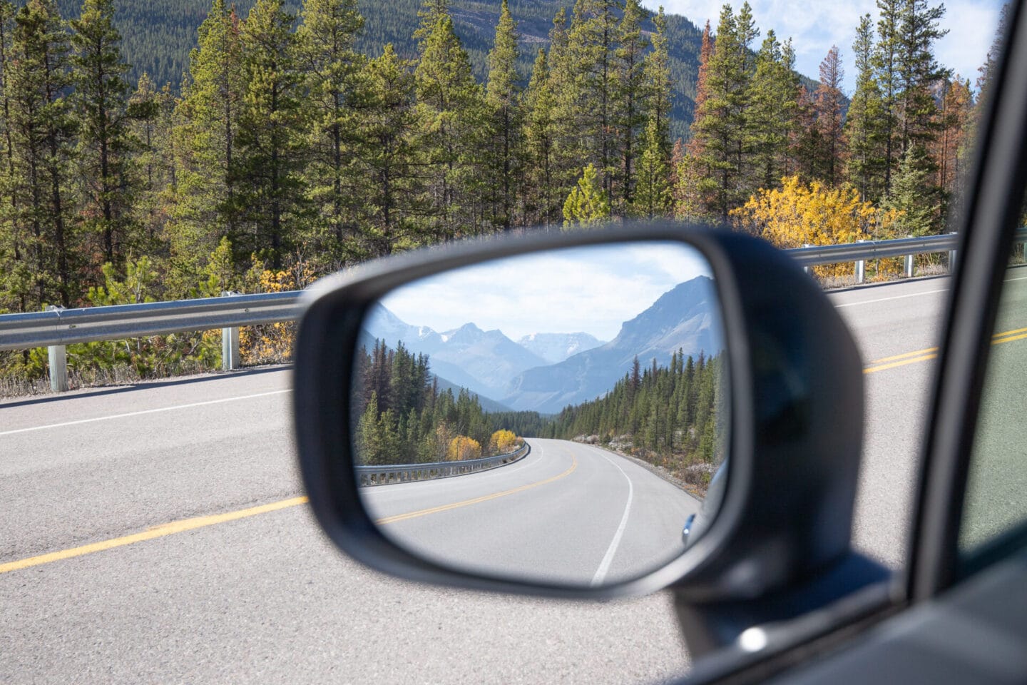
Best hikes in Vancouver: 22 Amazing Trails for 2024

Perched on the southwestern corner of British Columbia, Vancouver is surrounded by impressive provincial parks, forests and mountains which offer endless hiking opportunities. Over the past 3 years, I’ve been making my through the best hikes in Vancouver, BC.
The nice thing about living in the city is that you don’t have to travel far to get to the best Vancouver hikes. Within 30 minutes of leaving downtown you can be wandering through lush rain forests and hiking up dramatic mountain peaks which overlook spectacular fjords and rivers.
Whether you’re new to Vancouver or visiting for a few days, I’ve rounded up 22 of the best hiking trails Vancouver has to offer. Some are short and easy trails, whilst others are more challenging and technical but they all offer incredibly scenic views. If you’re looking to explore further afield, this guide also includes the best hikes around Vancouver. These are great day hikes from Vancouver and most of them are only an hour or so away from the city.
Disclaimer: This blog post features some affiliate links, which means I get a small commission if you make a purchase. There’s no extra cost to you but it just helps me to keep writing these free guides and itineraries for my readers. Thank you for your support!
The best hikes in Vancouver: Planning tips
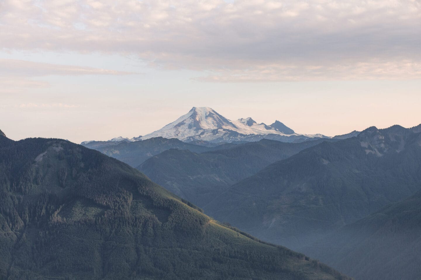
The majority of these trails are relatively popular and well-maintained but remember that there are certain precautions you need to take. Each year, a number of people get into trouble whilst out hiking and need to be rescued. This is often due to a lack of preparation. Don’t put yourself at risk, make sure you are properly informed and prepared.
Before you head out on any hikes in Vancouver, you must:
- Research your trail and know how long it should take, the level of difficulty, and ensure you have enough food and water to sustain you during the hike.
- Check BC Parks website for current trail conditions to make sure it is safe and there aren’t any restrictions in place.
- Check the weather conditions and remember that the temperatures will be cooler as you gain elevation. The weather can change quickly in the mountains so make sure you take layers and waterproof clothing just in case.
- Print a physical map of the trail or download an offline map. I use AllTrails.
- Tell someone your plans before heading off. This is really important as often you won’t have signal on the trails so you should make sure someone knows where you are going.
Leave no trace
Please follow the Leave No Trace Principles during your time in nature. These 7 principles are guidelines to help you plan, prepare and explore the outdoors more responsibly. They include staying on the designated trails, not touching or removing any natural objects, packing out all your trash, and respecting wildlife. By following these principles, you can reduce your impact on wildlife and nature.
Remember you are in the wild so you may encounter wildlife such as coyotes, mountain lions, and bears. Seeing a bear is an incredible experience but safety is the top priority. Bears are solitary creatures and will fiercely defend themselves and their cubs. For your safety and theirs, it is best to avoid any bear encounters. I recommend reading this article on bear safety to make sure you’re properly prepared.
22 of the best hikes in Vancouver

Picking the best hikes in Vancouver is tough! There are so many great hikes in Vancouver but the following ones are my personal favourites due to the trails themselves or the incredible views you get along the way.
To make it easier, I’ve grouped the best hikes in Vancouver (and the best hikes around Vancouver) into 4 sections; North Shore, Howe Sound, Fraser Valley, and Whistler. At the end of this post you’ll find a map with the locations of all the best Vancouver hikes.
Due to the popularity of some hikes and high visitor volumes, BC Parks introduced a day pass system in the summer to help with physical distancing on the trails. At this time, day use passes are not required to visit any BC Parks but make sure you regularly check the website as any changes to this requirement will be posted there.
Hikes in the North Shore
1. Quarry Rock
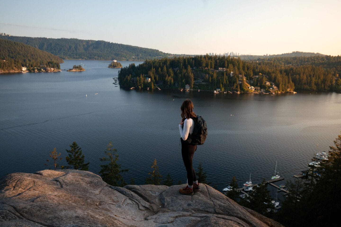
This is easily one of my favourite hikes in Vancouver. It’s a relatively short and easy hike but it offers beautiful views of the Indian Arm and the mountains around Belcarra Regional Park. The trail starts at Deep Cove in North Vancouver and is part of the longer Baden Powell hiking trail which connects Deep Cove to Horseshoe Bay.
The first section of the hike involves climbing a series of wooden steps through the forest. Once you reach the top, the trail continues to wind through the dense woodland of Douglas Fir and Hemlock trees, passing over small bridges and little streams. It’s a typical North Shore hike and the terrain is beautiful. The trail leads to a large rocky ridge known as Quarry Rock. It’s a lovely place to sit and take in the scenic views on a clear day.
Location: Deep Cove
Distance: 3.8 km
Elevation gain: 100 meters
Difficulty: Easy
Dogs allowed: Yes
READ NEXT | 12 Easy hiking trails in Vancouver for beginners >
2. Eagle Bluffs

Eagle Bluffs offers spectacular views of the city of Vancouver and Howe Sound. On a clear day, you may even be able to see as far as Vancouver Island and Mount Baker.
The trail starts from the downhill ski area of Cypress Mountain. Walk towards the nearest set of chair lifts and look for a trail on the left hand side that leads into the trees. It can be a bit difficult to find and the first time we did it we actually got lost.
The trail ascends quickly through a series of switchbacks and is quite steep at times so take your time and stop to look back at the views if you need to catch your breath. The trail passes by Cabin lake and Owen Lake before heading back downhill through the forest and out to the large view point.
Location: Cypress Provincial Park
Distance: 8 km
Elevation gain: 350 meters
Difficulty: Intermediate
Dogs allowed: Yes
3. St Mark’s Summit
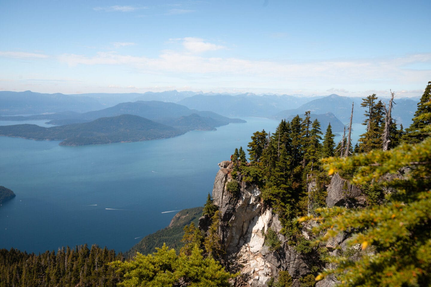
This may be one of the most iconic hikes around Vancouver. You’ve probably seen photos of the famous viewpoint which looks out over Howe Sound, the Tantalus Range, and the Gulf Islands in the distance.
The trail follows several ski runs uphill before veering right through the forest to join the Howe Sound Crest Trail. Along the way there are some stunning views through the trees of the Lions. You’ll go through a small meadow, over bridges, and up a series of switchbacks which become gradually steeper.
Eventually the trail will level out and you’ll have reached the upper region of St Mark’s Summit. There are a number of scenic viewpoints along the short ridge so make sure you have enough time to see them before heading back down.
Location: Cypress Provincial Park
Distance: 11 km
Elevation gain: 460 meters
Difficulty: Intermediate
Dogs allowed: Yes – on a leash
4. Pump Peak
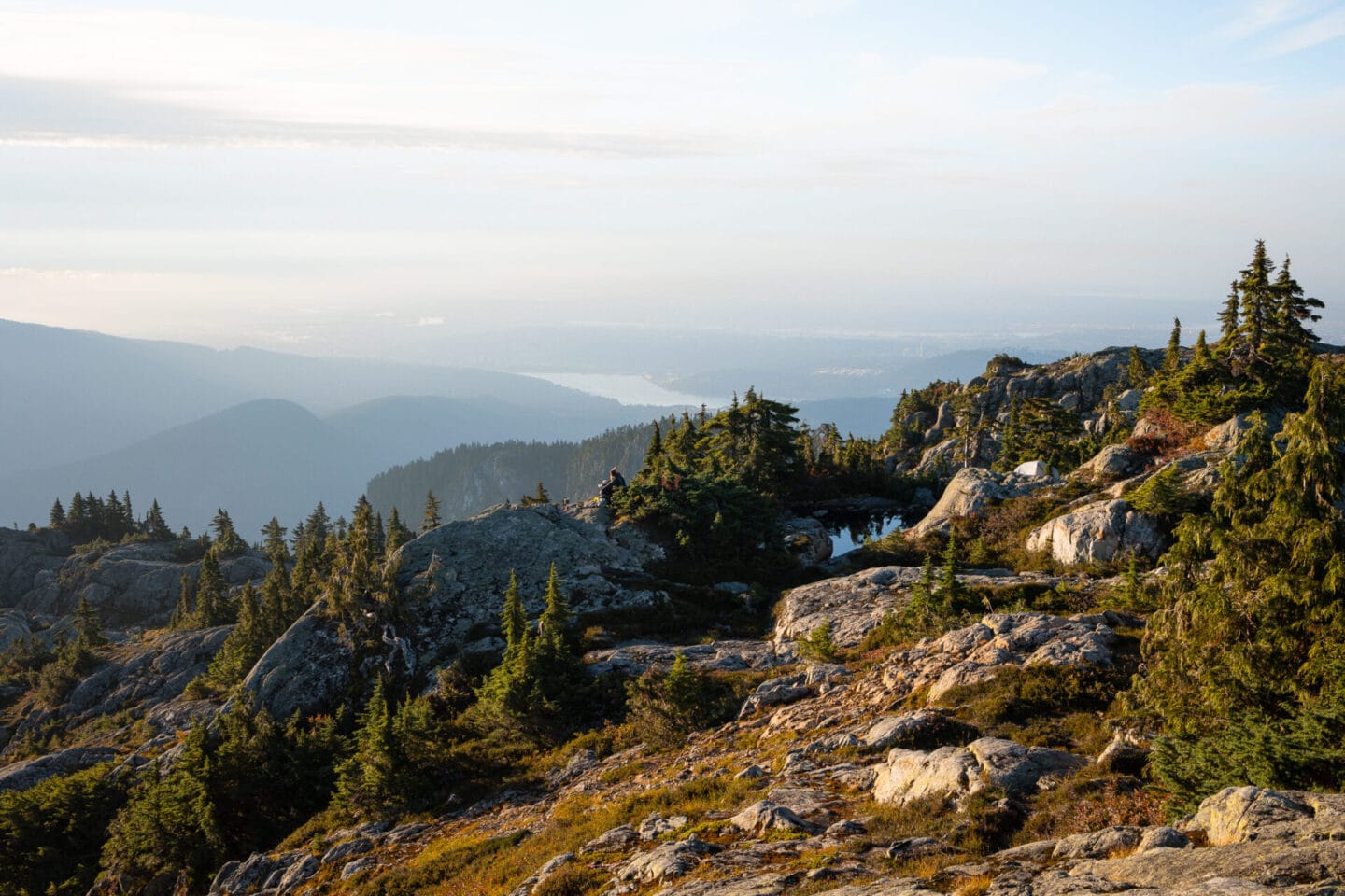
Pump Peak is one of the most popular hiking destinations on the North Shore. There are several incredible viewpoints along the trail which offer 360-degree views; however, the final viewpoint is the most iconic with views of both the city and back country mountains. Located in Mount Seymour Provincial Park, the hike to Pump Peak offers stunning 360-degree views.
With its proximity to Vancouver and beautiful views, Pump Peak is a heavily trafficked trail so be prepared for a lot of hikers in the summer months. As a result, it is relatively easy to follow and has clear markers along the well-defined path. The elevation gain is steady, with several steeper sections that may challenge newer hikers. The terrain is rocky and most of the trail is exposed, with only a few short sections under forest cover, so make sure you bring a sunhat and sunscreen.
Parking is available at the main lot for Mount Seymour Provincial Park, located next to the trail head. If you’re looking to get into back country camping, this is a great option. It is steep at times which can be challenging with a heavy back pack but it is one of the shorter trails near Vancouver. We camped up at Pump Peak at the end of summer in 2023 and it still is one of my favourite backpacking trips to date!
Location: Mount Seymour Provincial Park
Distance: 7 km
Elevation gain: 457 meters
Difficulty: Intermediate
Dogs allowed: Yes – on a leash
5. Dog Mountain
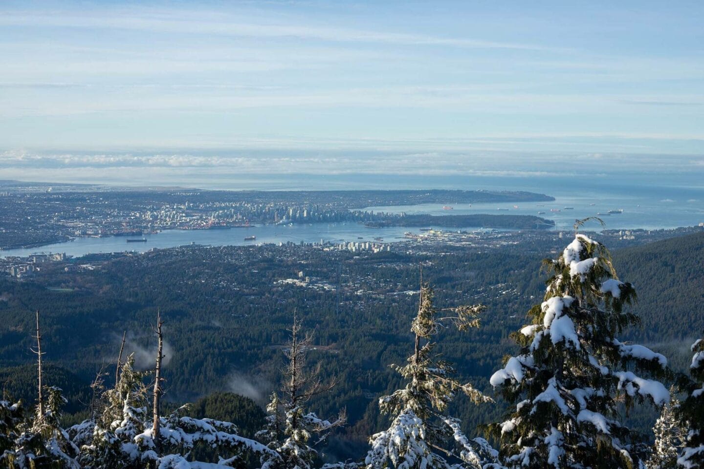
Located at Mount Seymour, Dog Mountain is another easy yet rewarding hike in Vancouver. The trail has minimal elevation but watch out for some rocky sections where you have to step over tree roots.
The trail passes First Lake and several small streams where you’ll cross some cute wooden bridges. There are a few hills to climb along the way but it’s a gentle incline. As you get closer to the peak, the trail veers left and leads you out of the forest towards a lovely view of North Vancouver. On a clear day, you can sit and look out at Lions Gate Bridge, Stanley Park, and downtown Vancouver.
Location: Mount Seymour Provincial Park
Distance: 5 km
Elevation gain: Minimal
Difficulty: Easy
Dogs allowed: Yes – on a leash
6. Grouse Grind

I couldn’t write about the best hikes in Vancouver and not include the Grouse Grind! This popular hike climbs more than 850 meters in just 3 km and requires physical strength and stamina to complete!
The trail begins on the right hand side of Grouse Mountain Gondola and is a continuous uphill climb. It does level out for a little while until you reach a fork in the trail where it continues upwards over rocks and roots.
Each quarter is marked with a large sign to encourage hikers but also to help you decide whether or not you want to continue. If you are finding it difficult at the first quarter or don’t have enough water, then it is probably better to stop here and try again another day. The third quarter is the steepest and requires you to cross over rock in some sections. Once you reach the top, you can enjoy the views and meet some of the animals that live in the Wildlife Refuge, including the two grizzly bears, Grinder and Coola.
Location: Grouse Mountain
Distance: 2.9 km
Elevation gain: 853 meters
Difficulty: Difficult
Dogs allowed: No
7. Big Cedar and Kennedy Falls

This rugged trail is one of the best hikes in Vancouver but is not as well-known as many of the other trails in this guide. The trail weaves through Lynn Headwaters Regional Park in North Vancouver. It takes you to the Big Cedar tree which is over 600 years old, before arriving at the impressive Kennedy Falls. Please note that this tree is at risk due to erosion so don’t touch or try to climb on it.
It’s a fun but challenging trail which requires you to cross tree roots, small boulders and little streams. In the summer, these creek beds are dry so it’s easy to cross them. However, if you plan to do this North Vancouver hike in early spring, bear in mind that the snow will have just melted. This makes crossing the creeks more challenging as the water can be quite high. Wear waterproof shoes and bring spare socks!
Location: Lynn Headwaters Regional Park
Distance: 13 km
Elevation gain: 497 meters
Difficulty: Intermediate
Dogs allowed: Yes – on leash
8. Hollyburn Peak Trail

Hollyburn Peak Trail in Cypress Provincial Park, near Vancouver, is a great hike if you want epic views but only have half a day. This popular trail spans approximately 7 kilometers round trip and features a steady ascent through lush, forested areas. There are a few steep sections but for the most part the incline is quite steady. Most of the trail is forested, providing pleasant shade from the sun during the summer. The peak offers excellent views of Vancouver, Burrard Inlet, and the Lions off in the distance.
There is usually snow on the top part of the trail until the end of summer so make sure you pack spikes and poles. You can do this hike all year round but it is especially beautiful in winter as a snowshoe trail when the mountains are dusted in snow. It’s one of my favourite hikes to do in winter.
Location: Cypress Provincial Park
Distance: 8 km
Elevation gain: 432 meters
Difficulty: Intermediate
Dogs allowed: Yes – on a leash
9. Mount Strachan

If you’re looking for the best hikes in Vancouver and want something more challenging, try Mount Strachan. This hike takes you up one of the three mountains that make up the Cypress Ski Resort area, passing the historical crash site of a Royal Canadian Navy T-33 Jet.
The terrain is testing and difficult at times as you have to scramble up an area of the Howe Sound Crest Trail known as Christmas Gully. Hiking poles can be useful for this uphill section across the rocky creek bed. Make sure you have bug spray for this section as there can be a lot of insects and mosquitos in the summer months. The trail is well marked at the start but as you start to climb higher the markers are not always obvious so download a map or use the AllTrails app.
On the way back down, you’ll go down the Old Mount Strachan route where you’ll see the site of the T-33 plane crash of 1963. The area has been preserved and there are still several pieces of the aircraft in the forest to mark the site.
Location: Cypress Provincial Park
Distance: 10.5 km
Elevation gain: 550 meters
Difficulty: Intermediate
Dogs allowed: Yes – on a leash
Hikes around Howe Sound
10. Tunnel Bluffs

Tunnel Bluffs is one of the best scenic hikes in Vancouver in my opinion. The trail starts from Lions Bay and climbs steeply up a series of switchbacks. After about 40 minutes, you’ll veer left and continue through the forest. The rest of the trail is flat or has a very minimal elevation gain. You’ll cross over a couple of wooden log bridges that take you over some small creeks.
As you get closer to Tunnel Bluffs, the trail comes to some rocks that you’ll need to climb up. These can be quite muddy after a few days of rain so make sure you have the right footwear on for this short section. Once you get to the top, you’ll be greeted with an incredible view looking out towards Bowen Island, Keats Island, and the Sunshine Coast.
Location: Cypress Provincial Park
Distance: 11.5 km
Elevation gain: 470 meters
Difficulty: Intermediate
Dogs allowed: Yes
11. Watersprite Lake

Located in the southern region of Garibaldi Provincial Park, this hike isn’t the easiest to get to but the views are worth it. To get to the trail head you’ll need a 4×4 to drive 20 km down the Mamquam and Skookum Forestry Service Roads. The trail passes Skookum Dam and Skullhead Creek, before climbing up a steep and rocky section to a viewpoint overlooking the valley below.
The trail continues over a rockslide before entering the forest at the far end. The final section involves crossing a second steep boulder field. Once you reach the top of the rocks, the beautiful turquoise coloured Watersprite Lake comes into view, along with the stunning Martin Peak and Dreadnought Peak.
Location: Squamish
Distance: 17 km
Elevation gain: 660 meters
Difficulty: Intermediate
Dogs allowed: No
12. Murrin Loop and Jurassic Ridge Trail
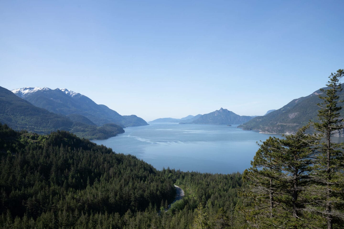
Located in Murrin Provincial Park, this trail offers spectacular views over Howe Sound, Browning Lake and some of the region’s towering mountains.
Although it is a short hike, it is steeper and more technical compared to some of the other easier hiking trails in Vancouver. Some websites class it as moderate as the climb up to Jurassic Ridge can be quite relentless for beginners. If you want an easier hike, you can bypass Jurassic Ridge and just do the Murrin Loop Trail which will still take you to Quercus viewpoint so you won’t miss out on the lovely view.
Location: Murrin Provincial Park
Distance: 2.4 km
Elevation gain: 162 meters
Difficulty: Easy / Intermediate
Dogs allowed: No
Hikes in the Fraser Valley
13. Lindeman Lake

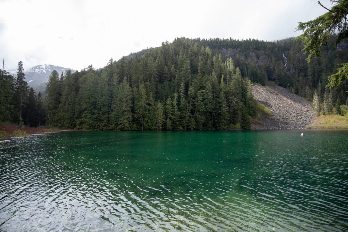
If you’re looking for short but beautiful hikes around Vancouver, Lindeman Lake is a wonderful day-hike. The trail takes you through the forest and climbs steadily before reaching this gorgeous, green lake which is surrounded by a lush green forest and mountain peaks.
The small beach area at the lake is a beautiful spot for a picnic. You can also continue to walk around the lake to get to the viewpoint in the photo below. It does involve crossing some sections of boulders which can be tricky at times.
Location: Chilliwack Lake Provincial Park
Distance: 3.4 km
Elevation gain: 300 meters
Difficulty: Easy / Intermediate
Dogs allowed: Yes
14. Greendrop Lake
If you’re hiking to Lindeman Lake and want to extend your hike, you can continue to Greendrop Lake. Follow the trail around the lake shore and over the boulder field to the other end of the lake. From here it’s another 4 km to the lake making it an 11 km round trip. It’s quite a technical hike and involves traversing several large boulder fields but if you’re an experienced hiker it’s a great hike. There’s also a campground at the lake so you’ll see a lot of hikers backpacking to this spot.
Location: Chilliwack Lake Provincial Park
Distance: 11 km
Elevation gain: 469 meters
Difficulty: Intermediate
Dogs allowed: Yes
15. Cascade Falls

This is less of a hike and more of a short trail, but I’ve included it as Cascade Falls is a beautiful gem in the Fraser Valley. The trail takes you through the forest to the scenic waterfall and the suspension bridge that crosses the river. The best time to visit is in early Spring or after a heavy rainfall as the waterfall is more powerful and flows down into the canyon.
Location: Mission
Distance: 0.75 km
Elevation gain: 40 meters
Difficulty: Easy
Dogs allowed: Yes
16. Elk Mountain

Located in Chilliwack, Elk Mountain is one of the best hikes near Vancouver. However, from personal experience, I can tell you that it is a challenging hike. It’s uphill all the way and gets very steep as you get closer to the peak.
The trail for the first half of the hike is wide and well maintained and takes you through a beautiful forested area. The second half gets a lot steeper and the dirt can be loose and slippery in places. I would highly recommend taking hiking poles and maybe even spikes or Yaxtrax to give you extra grip for that final section.
The views from the top are spectacular and are definitely worth the grind to get to the peak. On a clear day, you’ll be able to see the border peaks that separate British Columbia and Washington in the US.
Location: Chilliwack
Distance: 8.2 km
Elevation gain: 746 meters
Difficulty: Difficult
Dogs allowed: Yes – on a leash
Hikes near Whistler
17. Garibaldi Lake

Nestled between alpine mountains, Garibaldi Lake is one of the most scenic places in British Columbia. The trail begins with 6 km of switch backs which can be steep at times. Shortly after the 6 km mark, you’ll reach a junction where you can go right directly to Garibaldi Lake, or left to Taylor Meadows. If you choose the latter, you’ll add on a few kilometres to your hike but it’s definitely worth it in the summer and early fall when the meadows are filed with alpine flowers.
The trail meanders through the meadows before leading to a series of downhill switch backs that will take you down to the lake. The hike takes about 5 – 6 hours in total. A lot of people choose to camp overnight at Taylor Meadows or Garibaldi Lake so they can hike Panorama Ridge or Black Tusk the next day. If you choose to do this, you’ll need to make a reservation at one of the two campsites in advance as they sell out quickly each year.
Location: Garibaldi Provincial Park
Distance: 18 km
Elevation gain: 820 meters
Difficulty: Intermediate
Dogs allowed: No
READ NEXT | Hiking to Garibaldi Lake: Everything you need to know >
18. Panorama Ridge
This is probably one of my favourite hikes near Vancouver. The beginning of the trail is the same as Garibaldi Lake but when you reach Taylor Meadows, you need to follow the signs to Panroama Ridge instead of the lake.
The final section of the trail is very steep as you begin to scale the side of the mountain. The terrain eventually becomes all rocks and you need to scramble to reach the top. Take your time and watch your footing as some rocks are loose. Once you reach the top, you’ll be rewarded with one of the most scenic views in Garibaldi Provincial Park! Due to the distance and elevation gain, many people choose to split the hike over two days.
Location: Garibaldi Provincial Park
Distance: 30 km
Elevation gain: 1520 meters
Difficulty: Difficult
Dogs allowed: No
READ NEXT | A complete guide to hiking Panorama Ridge in a day >
19. Joffre Lakes

Joffre Lakes is one of Vancouver’s most beautiful and popular hikes which passes three stunning turquoise lakes. Despite the distance, it’s a relatively moderate hike which offers impressive views of the Matier glacier which towers above.
Lower Joffre Lake is only a short walk from the main trail and on a clear day you can see the Glacier in the distance. The section between Lower and Middle Joffre Lakes is the most challenging part of the trail as you climb through old growth forests and a boulder field. Luckily, you’re rewarded with sweeping views over the coast mountains and valleys below. On the way to the Upper Joffre Lake, you’ll come across a scenic waterfall before scrambling up some more rocks and roots to reach the top to find the third and final lake.
Location: Pemberton
Distance: 10 km
Elevation gain: 370 meters
Difficulty: Intermediate
Dogs allowed: No
READ NEXT | Joffre Lakes: The Ultimate Hiking and Camping Guide >
20. Wedgemount Lake

This is a spectacular but challenging hike and isn’t suitable for beginners. It’s one of the more difficult trails in Garibaldi Provincial Park and climbs 1100 meters in just 7 km. The trail begins by weaving through a second-generation growth forest before climbing through a series of switchbacks. You’ll cross a rockslide which offers lovely views of the valley below. The trail becomes steeper as it continues uphill. Keep an eye on your footing but don’t miss Wedgemount Waterfall which is visible at a few points along the trail.
The last section of the trail is the steepest as you have to scramble over rocks to the top. Hiking poles are recommended for this section. Climb carefully and eventually you’ll see the BCMC (British Columbia Mountaineering Club) hut come into view, as well as the exquisite turquoise-coloured Wedgemount Lake. Follow the trail to the end of the lake for a full view of the glacier.
Location: Garibaldi Provincial Park
Distance: 12 km
Elevation gain: 1160 meters
Difficulty: Difficult
Dogs allowed: No
21. Stawamus Chief

The Stawamus Chief is one of the largest granite monoliths in North America towering 702 metres above Squamish. Known locally as the Chief, it’s one of the most popular rock climbing and hiking destinations along the Sea to Sky. It’s a steep intermediate hike which offers incredible views over Squamish, Howe Sound, and Garibaldi Provincial Park. There are three summits; First Peak, Second Peak and Third Peak.
The three peaks:
- First Peak: 1.5 km trail with an elevation gain of 540 metres
- Second Peak: 1.7 km trail with an elevation gain of 590 metres
- Third Peak: 1.8 km trail with an elevation gain of 630 metres
Most people take the route up to Second Peak and then continue on to Third Peak which takes about 6 to 7 hours to complete. It’s one of the best things to do if you have a weekend in Squamish so make sure you add this to your itinerary!
Location: Stawamus Chief Provincial Park
Distance: 11 km
Elevation gain: 600 meters
Difficulty: Intermediate
Dogs allowed: Yes – on a leash
22. Shannon Falls Pools
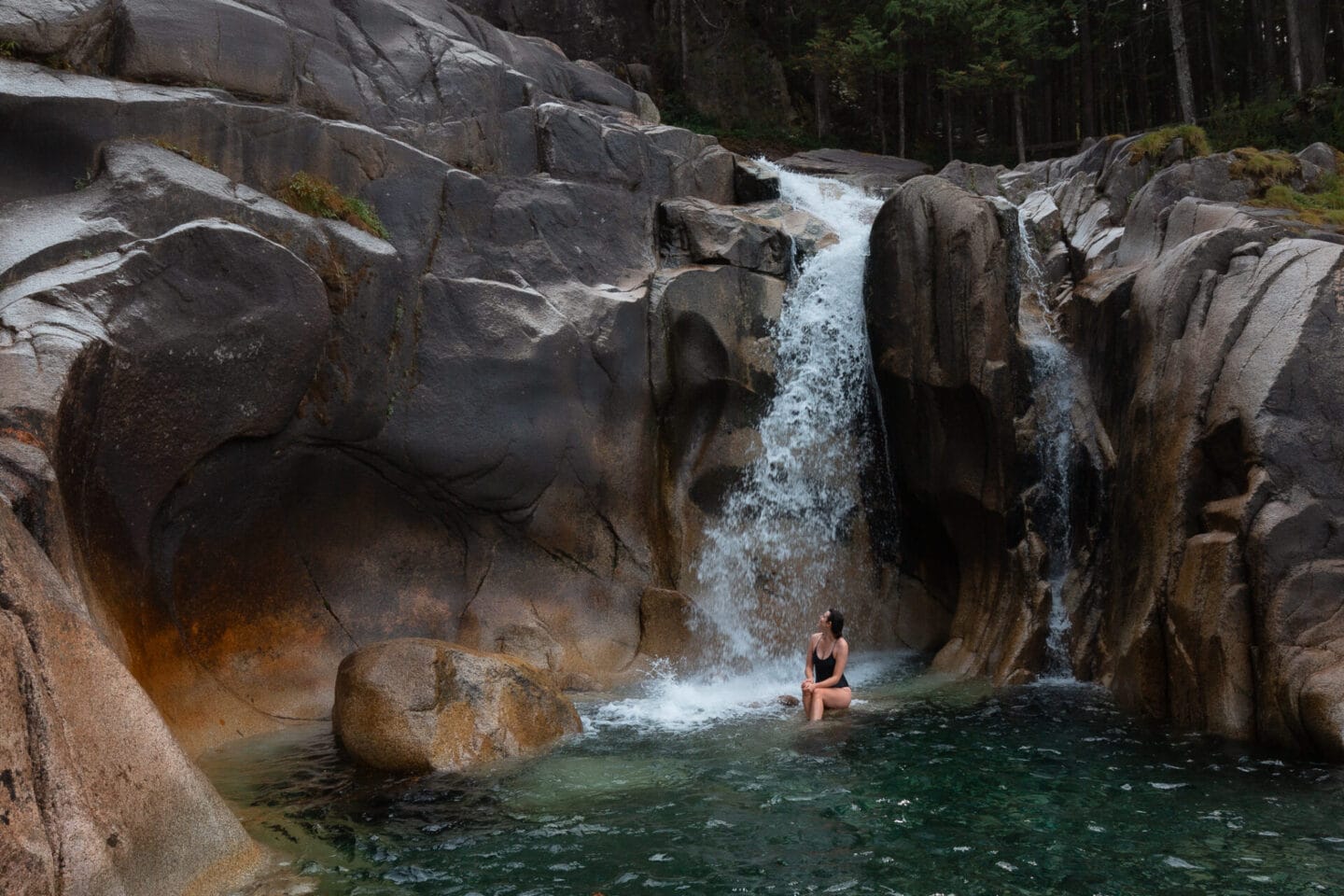
Located in the heart of Squamish, Shannon Falls stands as one of British Columbia’s most breathtaking natural wonders. Reaching a height of 335 meters, it ranks as the third-highest waterfall in the province and attracts numerous visitors to its spectacular viewing area. Yet, many are unaware that you can hike up to the pools above Shannon Falls.
This short but steep hike leads to tranquil pools above the falls, offering stunning views over Howe Sound. Don’t be fooled by the short distance! It is technical in places so I would class it as a moderate hike. You will have to climb some boulders using ropes provided and scramble in places. It’s a fun hike but it can be a bit daunting if you haven’t done anything like this before. The trail is mostly uphill so it can be hard work and you need a good amount of stamina.
At the top, you’ll find some beautiful pools created by the waterfall. You can swim in them but be very careful. In spring and early summer, the waterfall is very powerful and the rushing water can easily sweep you over the cliff edge if you’re not careful. Always assess the conditions and be sensible when out in nature. The best time to go is late summer or early fall when the water levels are lower.
Location: Shannon Falls Provincial Park
Distance: 2.4 km
Elevation gain: 243 meters
Difficulty: Moderate
Dogs allowed: No
READ NEXT | How to find Shannon Falls Pools: A hidden hot spot in Squamish >
Location details
I’ve marked the trail heads for all of these hikes around Vancouver on the map below. To save this map, click on the star on the right hand side of the title. This will save the map to “Your Places” in the Google Maps so you will have it when you visit Vancouver.
What to pack and wear

A lot of these hikes can be quite challenging due to the elevation and terrain. Having the right gear is essential. Here’s a summary of what you should take on these day hikes, along with links to gear I personally use and love:
The 10 essentials
Before you head out, make sure you’ve packed the 10 essentials. These include navigation, water, food, rain gear and insulation, fire starter, first aid kit, tools (to repair kit and gear), light sources, sun protection, and shelter. You should take these items on every hike, no matter the distance. If an emergency does arise, these items may help save your life.
Hiking backpack
If I can only give you one piece of advice, invest in a good hiking daypack. It will make hiking much more enjoyable and reduce the strain on your back and neck. You’ll want a bag with the following features:
- Adjustable straps
- Chest and waist strap (this makes such a difference!)
- Accessible pockets
- Clips or hooks for your poles (many bags don’t have this and it makes carrying your poles difficult when you’re not using them)
- Sleeve for your hydration reservoir if you use one
Osprey’s daypacks are rated really highly. Patagonia also has a great selection. I recommend going and trying them to get a feel for what fits you best.
Hiking boots
I can’t stress enough the importance of having comfortable and supportive hiking shoes. Some people like hiking boots while others prefer trail runners. The best thing to do is try on a few different styles to figure out what best suits your needs. I usually opt for waterproof and lightweight hiking boots with ankle support due to Vancouver’s climate and terrain. I’ve had my Keen Terradora II Waterproof Hiking Boots for over 2 years and have been really pleased with them.
Merino wool socks
As someone with very delicate feet, I highly recommend buying merino wool socks for hiking. They are more expensive but your feet will thank you. I always opt for Darn Tough, Icebreaker or Smartwool as they last a long time and protect your feet from blisters.
Trekking poles
I normally pack poles to take the pressure off my knees if I know there are some steep, downhill sections. You don’t want to add unnecessary weight so look for lightweight options such as the Black Diamond Alpine Carbon Cork Trekking Poles. I have the Black Diamond Trail Sport 2 Trekking Poles which are still light but more affordable.
Rain protection
The weather changes very quickly in the mountains. I’ve set off on a hike with the sun shining only to get caught in a cold downpour an hour later. Make sure you bring a rain jacket which can be easily packed away. I bought my Patagonia waterproof shell on sale in 2019 and I never go hiking without it. It’s lightweight and doesn’t take up much space in my backpack.
Layers
Avoid cotton and opt for merino wool or poly blends that are quick drying. One of my favourite breathable mid-layers is the Patagonia R1 Fleece as it provides a lot of insulation but is lightweight to carry in my backpack. In the cooler months, I also pack an additional layer, usually my Patagonia Down Jacket or Nano Puff Jacket, and a toque.
Bug protection
Mosquitoes and flies can be relentless on some of these Vancouver hikes. It’s a good idea to take some bug spray with you in the summer months. MEC has a great range of bug sprays and repellers.
Sun protection
Don’t forget to pack a sun hat, sunscreen and sunglasses if you’re hiking on a hot or bright day. I still pack polarised sunglasses in winter as they cut the glare reflecting off lakes and snow.
Final thoughts on the best hikes in Vancouver
There are so many beautiful hikes in and around Vancouver and these are just 22 of my favourites. I hope you found this post useful and it gives you some ideas for your next hike. If you have any questions about hiking in Vancouver, please let me know in the comments below and I’ll be happy to answer them!
Where to explore next?
If you’re looking for more hiking inspiration in British Columbia, have a look at these guides:
- 18 Beginner-Friendly Hikes Near Vancouver
- Joffre Lakes: The Ultimate Hiking and Camping Guide
- Hiking Panorama Ridge in a day
- How to find the secret Shannon Falls Pools
- A guide to hiking to Garibaldi Lake
Love from Steph
SAVE THIS POST FOR LATER


More Vancouver and BC inspiration
The complete guide to hiking Panorama Ridge in one day

Garibaldi Lake Hike: Everything you need to know
18 Amazing and Easy Hikes in Vancouver For Beginners
20 Beautiful Spots To See Cherry Blossoms In Vancouver: The 2024 Guide
The most awesome weekend getaways From Vancouver, BC